| Written
accounts |
In earlier times the Alpine
meadows at the edge of the Great Aletsch, the †ssers Aletschji and
Inners Aletschji Alpine pastures, were used intensively. The Inners Aletschji
pastures lie between the Oberaletsch Glacier and the Middle Aletsch Glacier.
Access to the Inners Aletschji was limited by the extension of both the
Upper Aletsch and the Great Aletsch Glaciers. The disappearance of the
Upper Aletsch Glacier after 1860 forced residents of the valley to seek
a new route across the ice of the Great Aletsch Glacier which still filled
the lower regions of the gorge. In time, the surface area of the Great
Aletsch Glacier also diminished and this route became impassable. When
the Great Aletsch Glacier recedes to the point where it is smaller than
it was in 1935-1940, access to the Inners Aletschji becomes impossible.
This source from the year 1480 reports use of the Alpine pastures in the
Inners Aletschji. The Great Aletsch glacier was more extended than today.
|
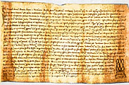
1 - Report on the use of Alpine pastures in the Inners Aletschji
|
| Maps |
Figure 2 - An old map shows
the terminal part of the tongue of the Great Aletsch glacier in 1755 (left
side). The glacier was about 900 to 1000 m shorter than it was in 1859/60.
Figure 3 - This map shows the Great Aletsch glacier in 1849.
The map is handdrawn an one of the first accurate map in Switzerland. |
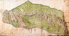
2 - Great Aletsch glacier in 1755 |
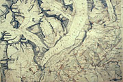
3 - Great Aletsch glacier in 1849
|
| |
After 1860 the Great Aletsch
glacier began to retreat. On this map from 1882 we see the Great Aletsch
glacier in its retreating period. The tongue is shorter than it was in
1849.
|
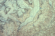
4 - Great Aletsch glacier in 1882
|
| Visual
records |
The following images show the Rhone glacier in the Valais
(Switzerland) during different time periods. Note the considerable retreat
of this glacier between 1849 and 2002 (images 8 and 10)!
|

5 - The Rhone glacier around about 1710. Etching by Johann
Melchior Füssli.
|
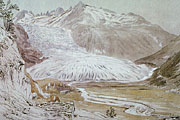
6 - The advance of the Rhone glacier in August 1824. Aquarell
from Samuel Birmann (Kupferstichkabinett des Kunstmuseums Basel).
|
| |
|
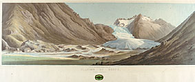
7 - The Rhone glacier in 26 August 1848. Lithography from
Henri Hogard.
|
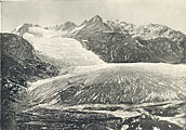
8 - One of the first photographs of an alpine glacier: The
Rhone glacier in 1849. Photographer: Gustave Dardel.
|
| |
|
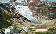
9 - A postcard shows Gletsch with the hotel Glacier du Rhone
around about 1900. The Rhone glacier has retreated since the last maximum
extension in 1856.
|
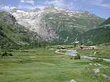
10 - A photograph taken in the summer 2002. From Gletsch
only a little from the Rhone glacier can be seen.
|


